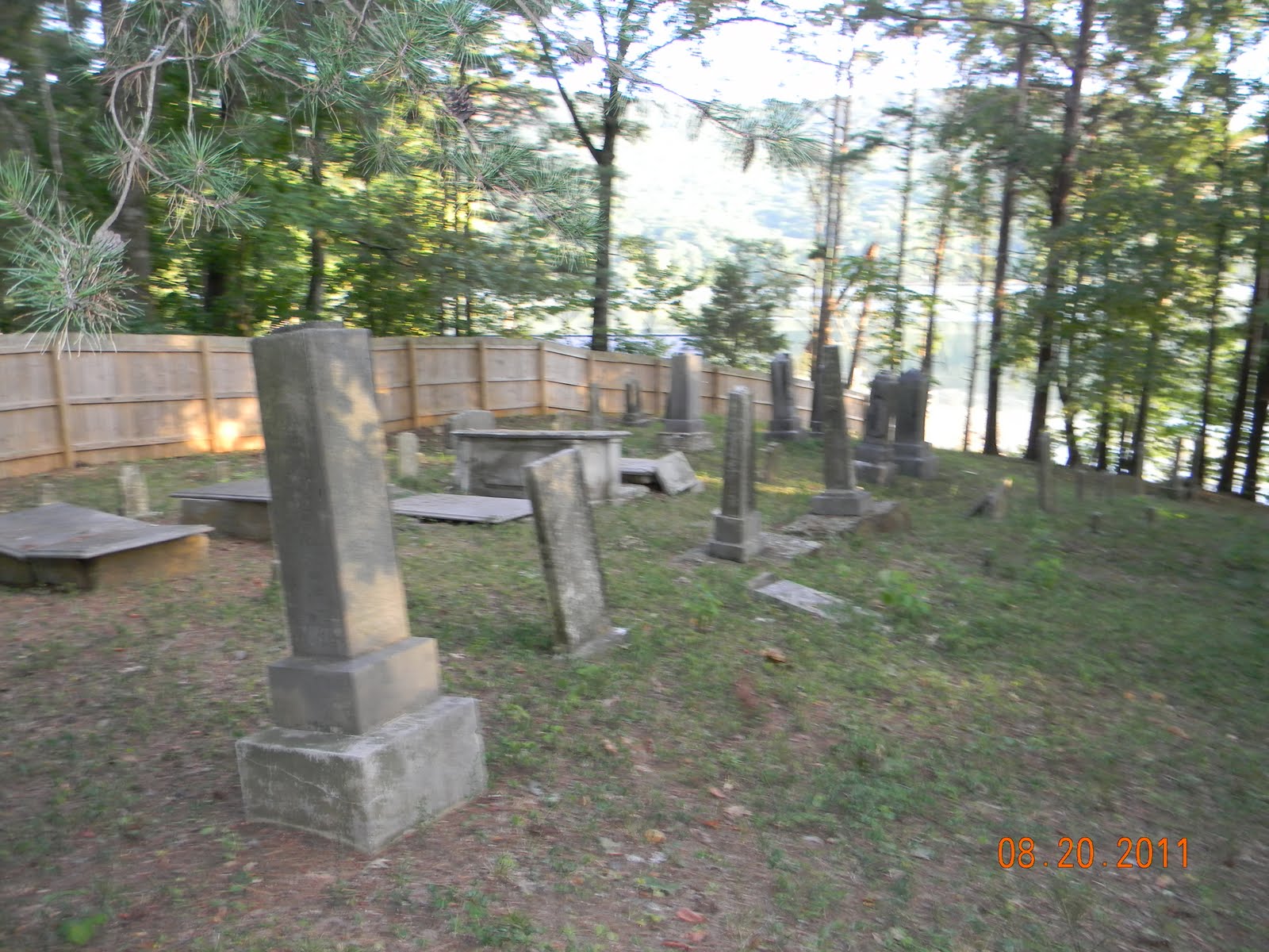
So I went looking for this graveyard for a Find a Grave request. It's near where Bennett's Lake Road and Mullin's Cove Road meet. I had never seen this one before, even in the many times I have been by it. Unfortunately there is a "no trespassing" sign posted and this is as close as I could get. For those of you familar with the area, I was pretty astonished at the proximity of this graveyard to the river, and the crypts were pretty cool too.
Showing posts with label Tennessee River. Show all posts
Sunday, August 21, 2011
Sunday, July 17, 2011
Tuesday, July 12, 2011
Marion Memorial Bridge Facts
Description
When new Dixie Highway (U.S. 41) was proposed through Haletown, this bridge was built as a toll bridge and dedicated to the county's veterans on the new highway alignment (the old Dixie Highway is still State Highway 28 through Ketner's Gap and down to Suck Creek). When TVA impounded Nickajack Lake, all the trusses were raised by hydralic lift 21 feet higher to allow for barge traffic on the lake's new elevated level. Although the Parker spans resemble K-Parkers, they are not K-spans. In the 1920's and 30's, Tennessee utilized the K-span concept to strengthen the state's longer Parker spans, but for financial reasons, did not incorporate the entire design into the superstructures. They are actually called K-hybrids.Facts
- Overview
- 2 Parker Camelback through trusses, and 2 Warren through trusses with Polygonal top chords, all riveted, over Nickajack Lake (Tennessee River)
- Location
- Marion County, Tennessee
- Status
- Functionally obsolete, better than minimum adequacy to tolerate being left in place as is
- Future prospects
- Scheduled for replacement
- History
- Built 1929; tolls removed 1947; rehabilitated 1966, and raised 21 feet higher when Nickajack Lake was impounded
- Builders
- - Tennessee State Highway Department - Tennessee Valley Authority
- Design
- Two Parker (Camelback design) through truss main spans with K-panel hybrids; Two Warren PTC through truss approach spans
- Dimensions
- Length of largest span: 369.1 ft. Total length: 1,870.1 ft. Deck width: 20.0 ft. Vertical clearance above deck: 14.6 ft.
- Recognition
- Posted to the National Register of Historic Places on September 6, 2007
- Also called
- Haletown Bridge
- Approximate latitude, longitude
- +35.02814, -85.54532 (decimal degrees) 35°01'41" N, 85°32'43" W (degrees°minutes'seconds")
- Approximate UTM coordinates
- 16/632701/3877130 (zone/easting/northing)
- USGS topographic map
- Sequatchie
- Inventory numbers
- NRHP 07000930 (National Register of Historic Places reference number) TN 58SR0020023 (Tennessee bridge number) BH 32614 (Bridgehunter.com ID)
- Inspection (as of 09/2008)
- Deck condition rating: Fair (5 out of 9) Superstructure condition rating: Poor (4 out of 9) Substructure condition rating: Fair (5 out of 9) Appraisal: Structurally deficient Sufficiency rating: 25.5 (out of 100)
- Average daily traffic (as of 2009)
- 2,250
- Information Obtained: BridgeHunter.com
Thursday, June 23, 2011
Subscribe to:
Posts (Atom)